I'm a photographer and digital media artist whose practice examines the politics of image-making in contested geographies, particularly Israel/Palestine. I work across 3D modeling, mapping, drone photography, and archival research to examine photography's entanglements with colonial and territorial politics.
I'm an Assistant Professor of Photography at Parsons School of Design, The New School.
Selected
- An Abridged Draft for a Letter to Leila Khaled
- Anti Mapping
- On the Optics of Mount Scopus
- Perpetual Motion of the Fourth Kind
- Gas, Stun, Smoke
- How to Photograph in the Land of Israel
- From the Shoe Box
Interactive
Other Works
- If the Fire within Our Eyes
- Duplicating Palestine
- Jerusalem Military Remains
- The First Trail
- Landscape in Continuum
- The Gardener's Post
- Mabat 2000
- The Jefferson Grid
- Bezalel 1
- Point Cloud Lifta
- Stereoscopic Reconstructions
Teaching Tools
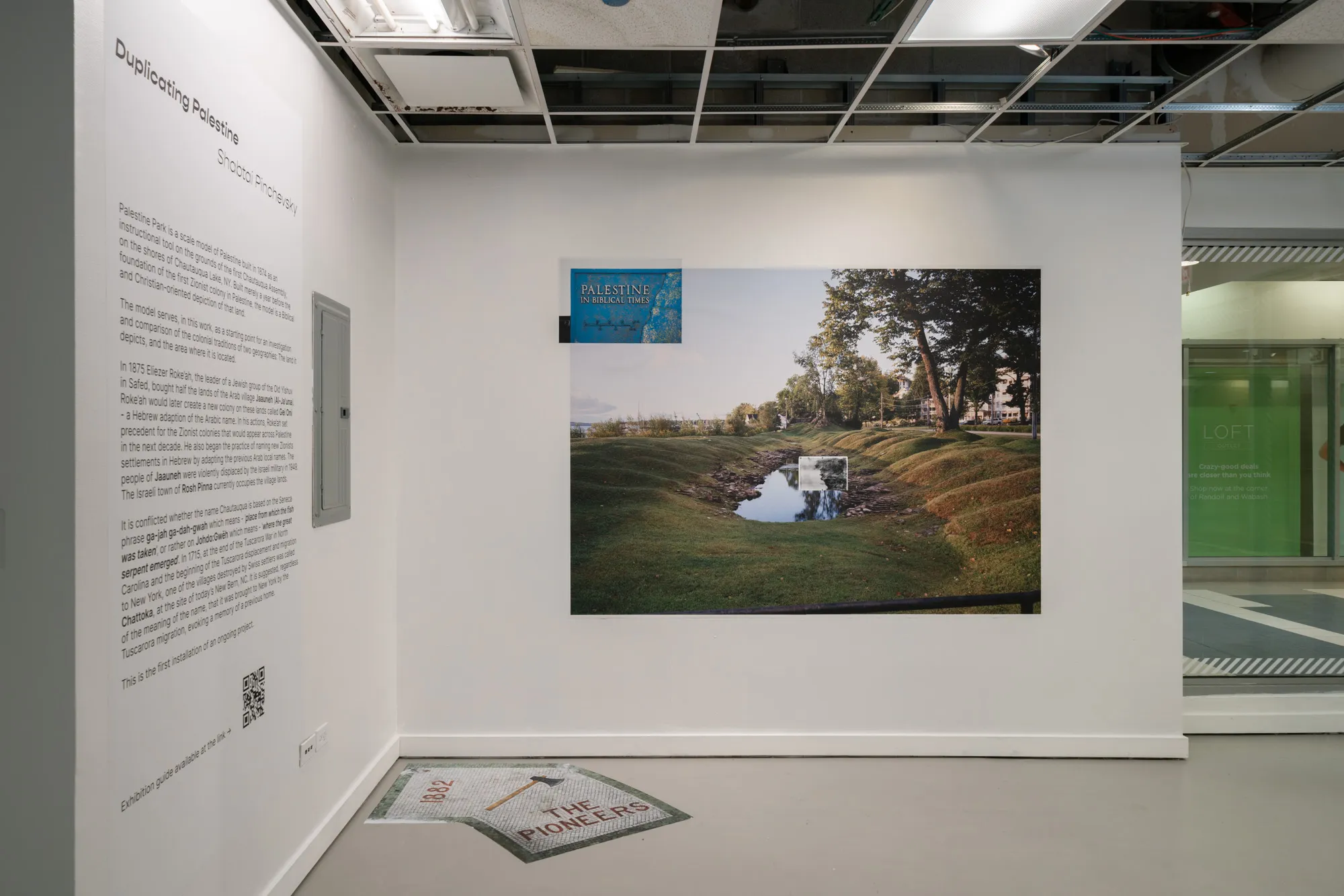
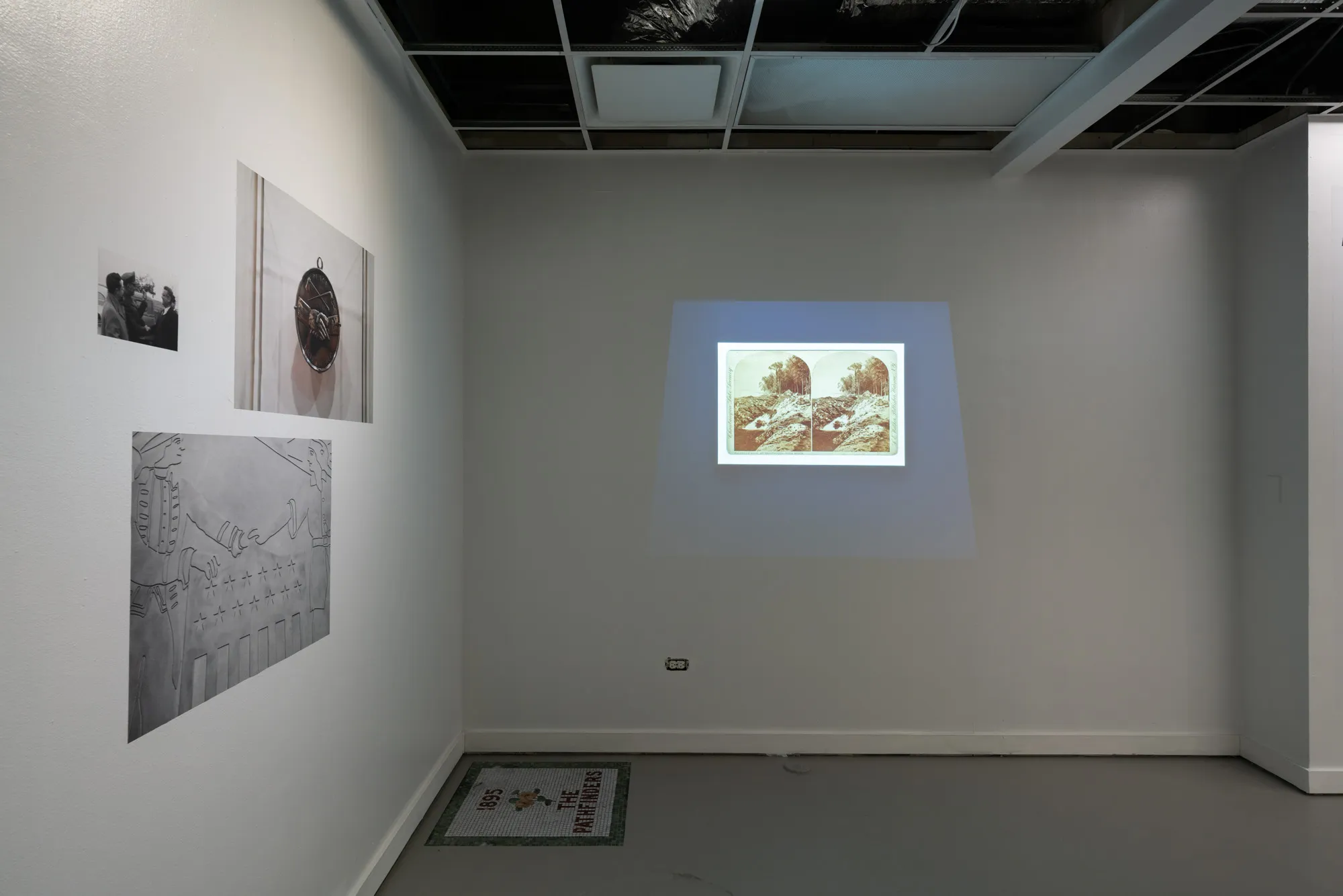
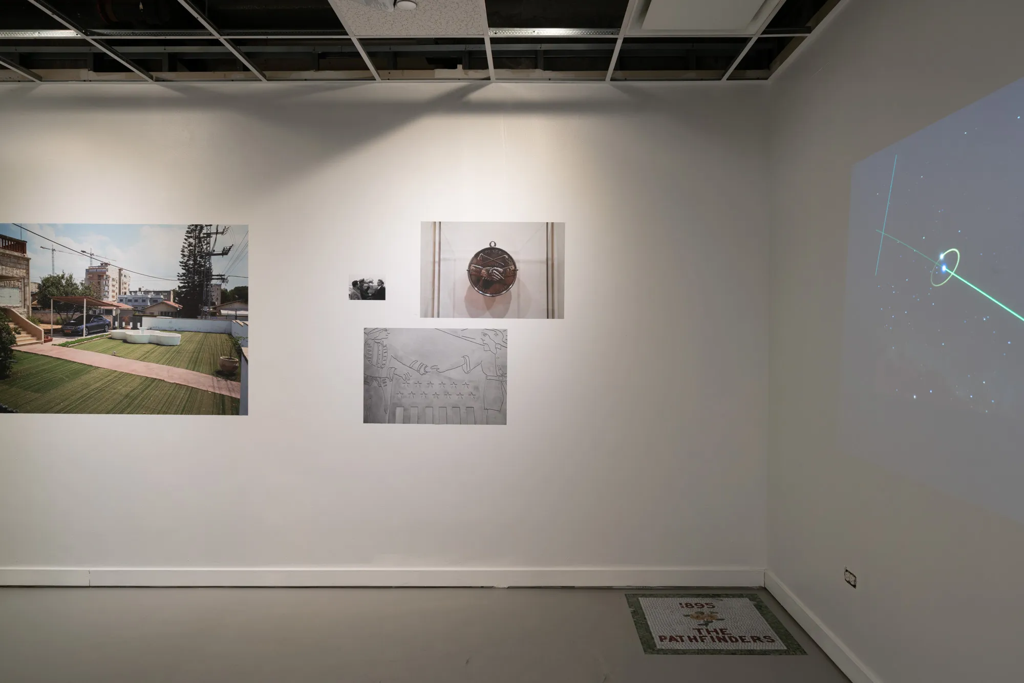
Duplicating Palestine
Palestine Park is a scale model of Palestine built in 1874 as an instructional tool on the grounds of the first Chautauqua Assembly, on the shores of Chautauqua Lake, NY. Built merely a year before the foundation of the first Zionist colony in Palestine, the model is a Biblical and Christian-oriented depiction of that land.
The model serves, in this work, as a starting point for an investigation and comparison of the colonial traditions of two geographies: The land it depicts, and the area where it is located.
In 1875 Eliezer Roke’ah, the leader of a Jewish group of the Old Yishuv in Safed, bought half the lands of the Arab village Jaauneh (Al-Ja’una). Roke’ah would later create a new colony on these lands called Gei Oni - a Hebrew adaption of the Arabic name. In his actions, Roke’ah set precedent for the Zionist colonies that would appear across Palestine in the next decade. He also began the practice of naming new Zionists settlements in Hebrew by adapting the previous Arab local names. The people of Jaauneh were violently displaced by the Israeli military in 1949. The Israeli town of Rosh Pinna currently occupies the village lands.
It is conflicted whether the name Chautauqua is based on the Seneca phrase ga-jah ga-dah-gwah which means - ‘place from which the fish was taken’, or rather on Johdo:Gwëh which means - ‘where the great serpent emerged’. In 1715, at the end of the Tuscarora War in North Carolina and the beginning of the Tuscarora displacement and migration to New York, one of the villages destroyed by Swiss settlers was called Chattoka, at the site of today’s New Bern, NC. It is suggested, regardless of the meaning of the name, that it was brought to New York by the Tuscarora migration, evoking a memory of a previous home.
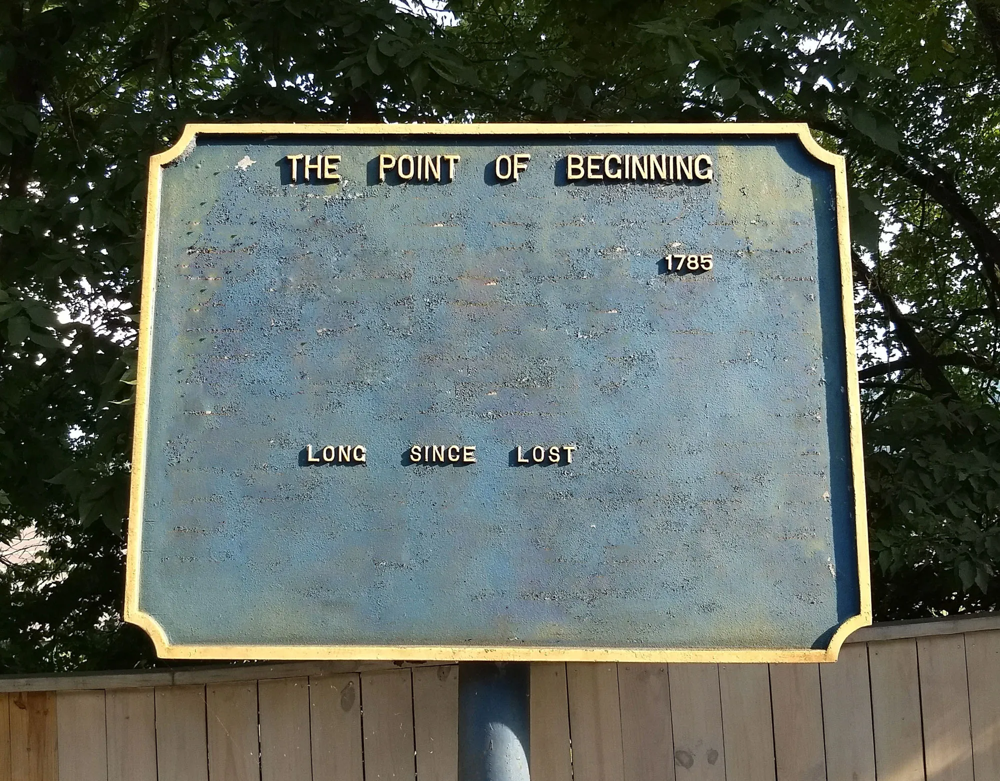
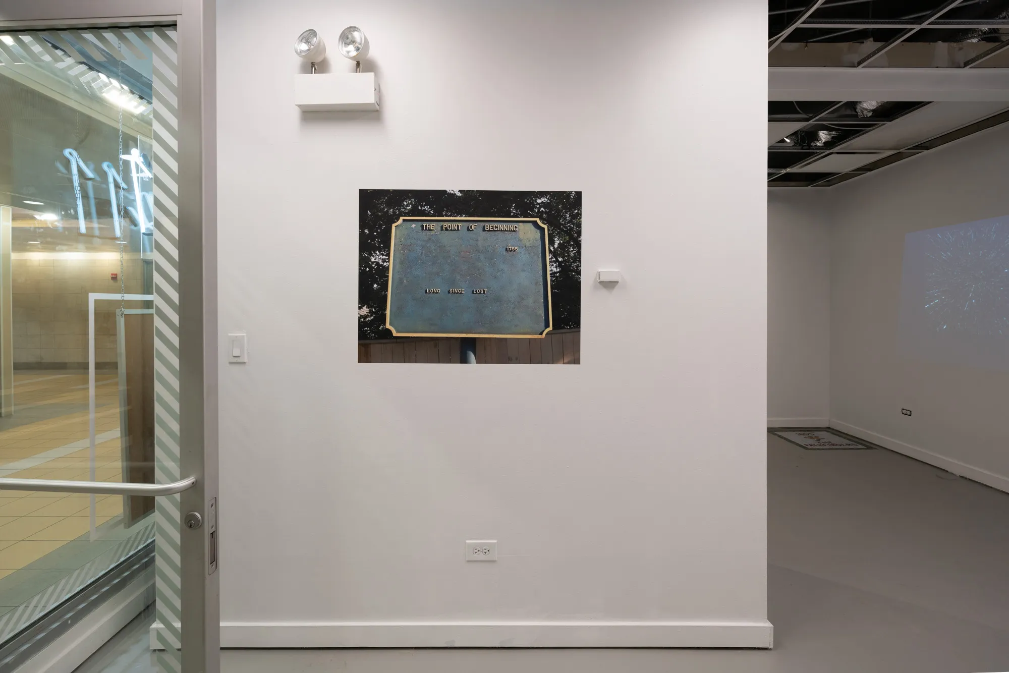
The Point of Beginning
The Beginning Point of the U.S. Public Land Survey is the point from which the United States in 1785 began the formal survey of the lands known then as the Northwest Territory, now making up all or part of Ohio, Indiana, Illinois, Michigan, and Wisconsin. The survey is claimed to be the first major cadastral survey undertaken by any nation. The point now lies underwater on the state line between Ohio and Pennsylvania.
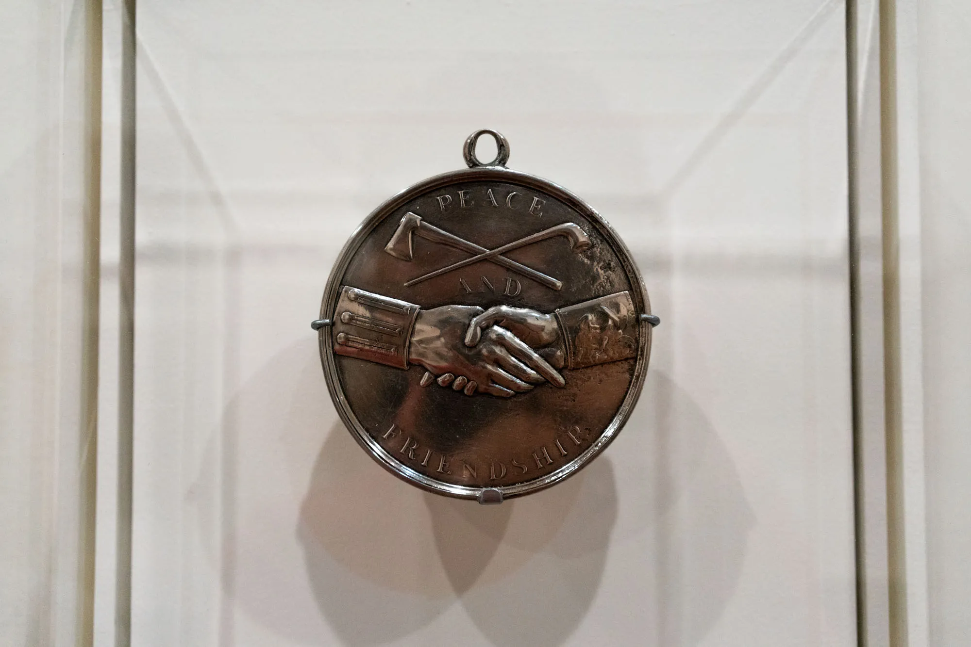
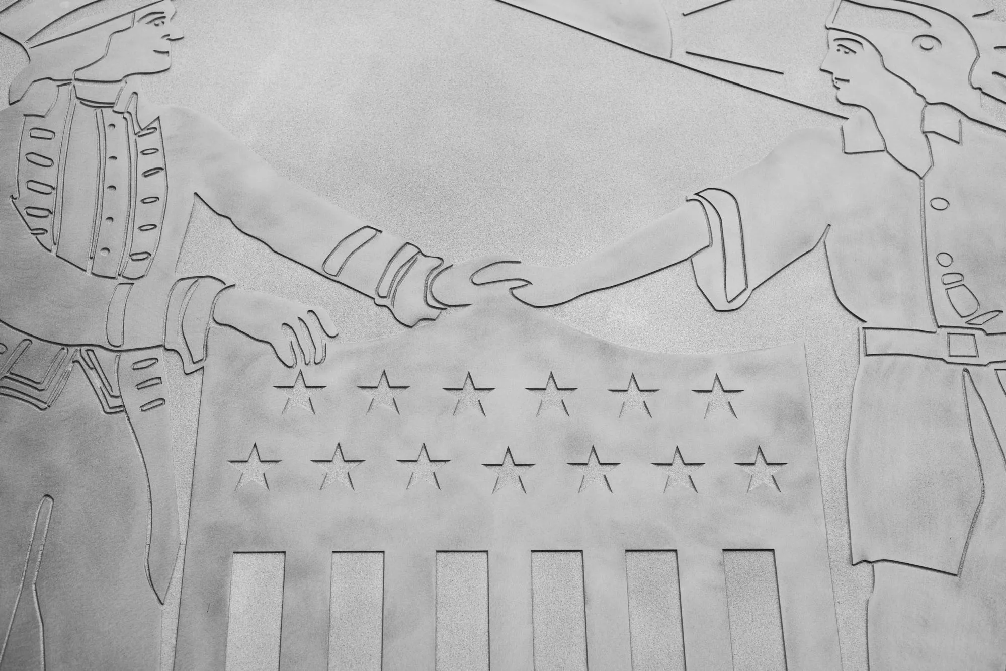
Thomas Jefferson Indian Peace Medal
In the late eighteenth and nineteenth centuries, silver peace medals were presented to Native leaders by presidents or their representatives as a sign of friendship and the promise that the U.S. government would honor treaties. Tragically, every treaty was broken, changed, or nullified when it served the government’s interests. For many Native people, peace medals came to symbolize broken promises. For others, they became status objects that were incorporated into traditional ornaments.
Seal of Madison County, New York
The Madison County DMV building, Wampsville, NY
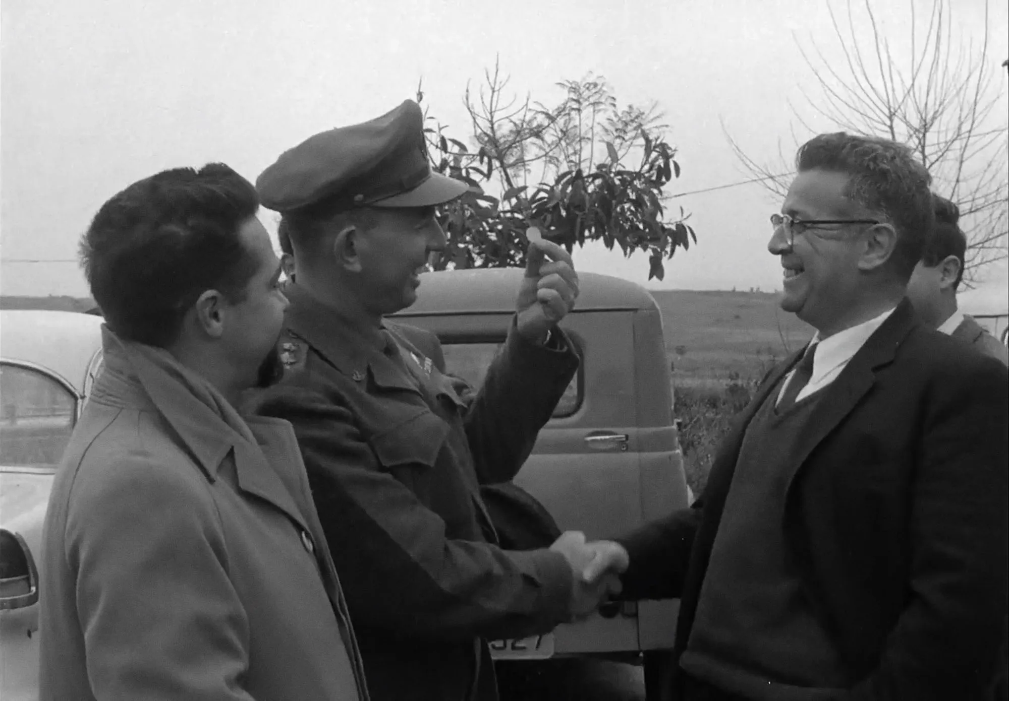
Issachar Shadmi paying a fine of 1 cent
In 1956, Issachar Shadmi was the Israeli commanding officer of the brigade responsible for the Kafr Qasim massacre. 49 people were killed (including 6 women and 24 children) by Israel Border Police, for violating a curfew they were not notified of.The border policemen who were involved in the shooting were brought to trial and found guilty and sentenced to prison terms, but all received pardons and were released in a year.Shadmi was found innocent of murder and received a symbolic fine of 10 prutot (one Israeli cent).
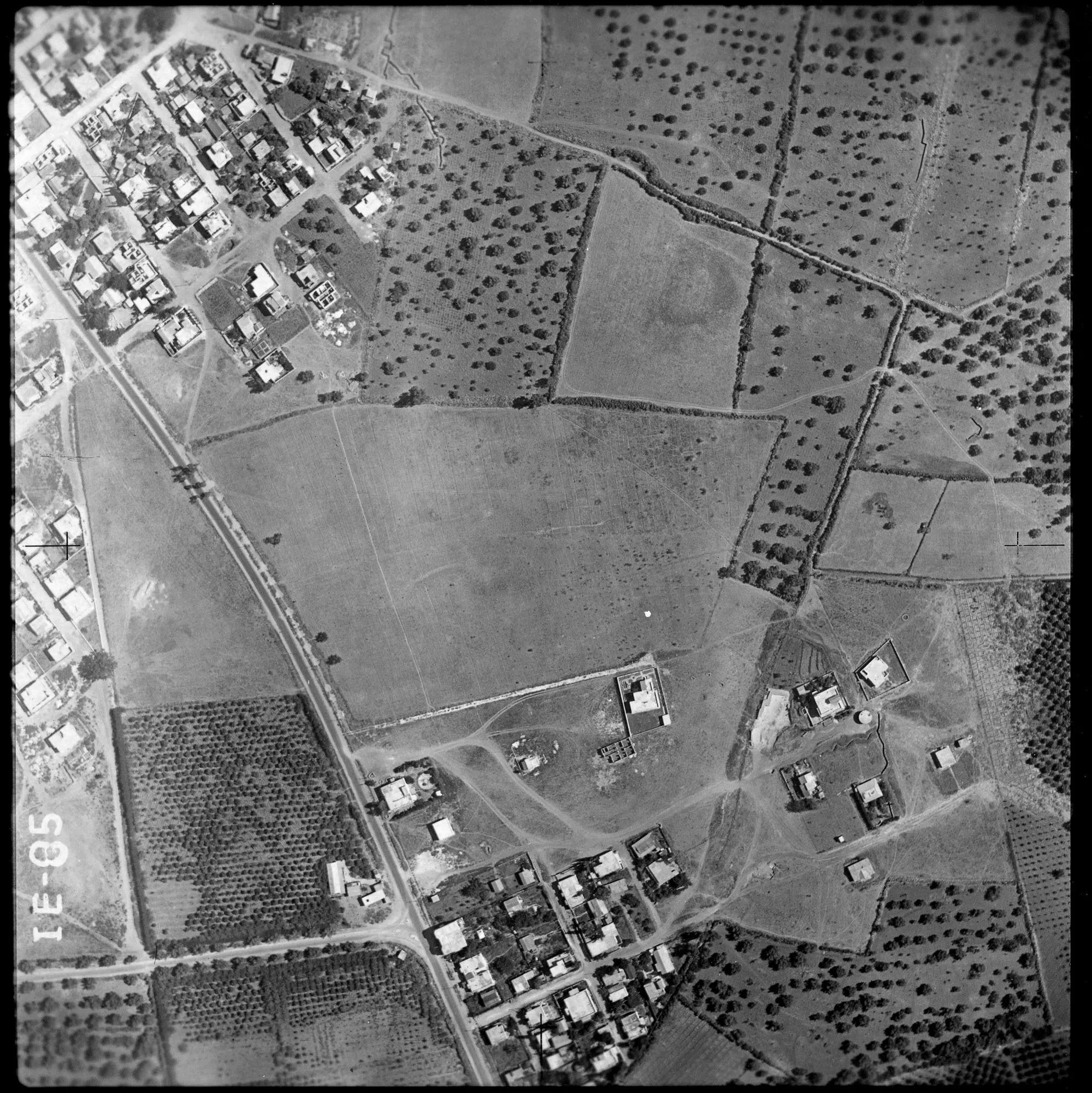
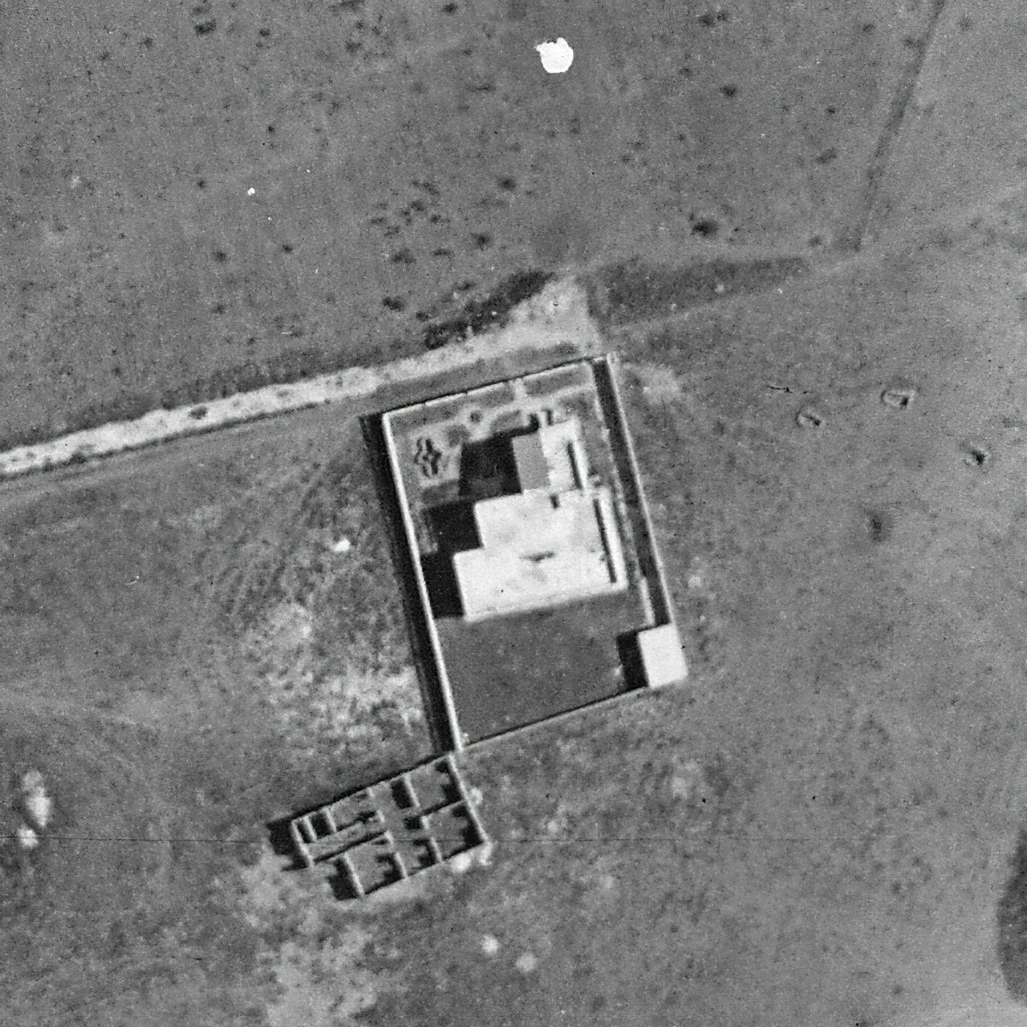
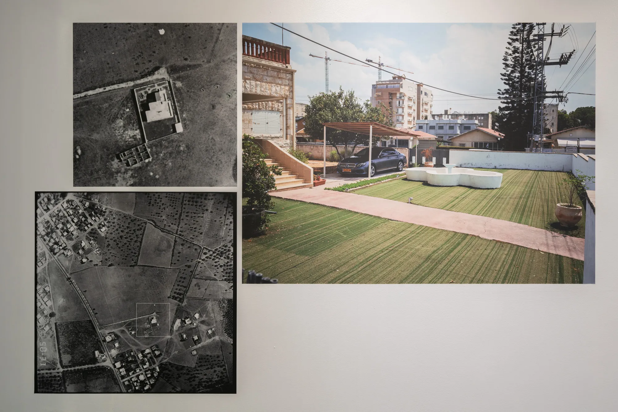
Aerial view of Ramle, Palestine, 1947. Original and magnification. Image from the Collection of the Palmach Squadron.
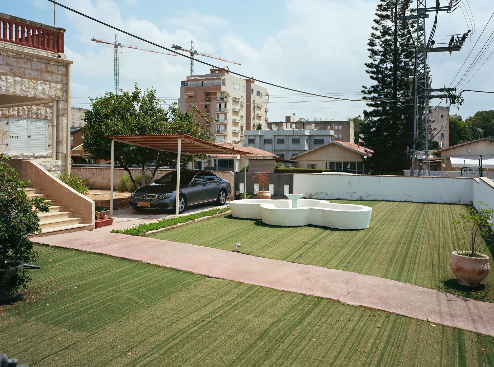
Ramle, Israel, 2021
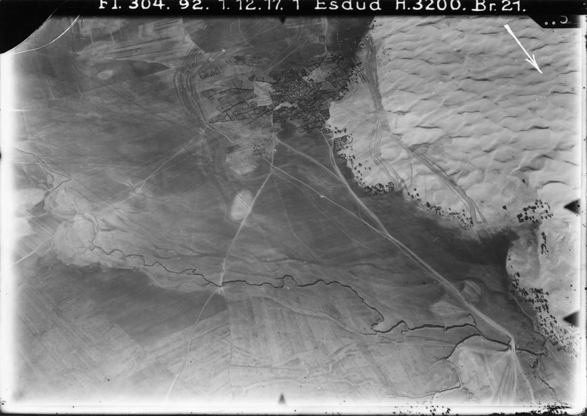
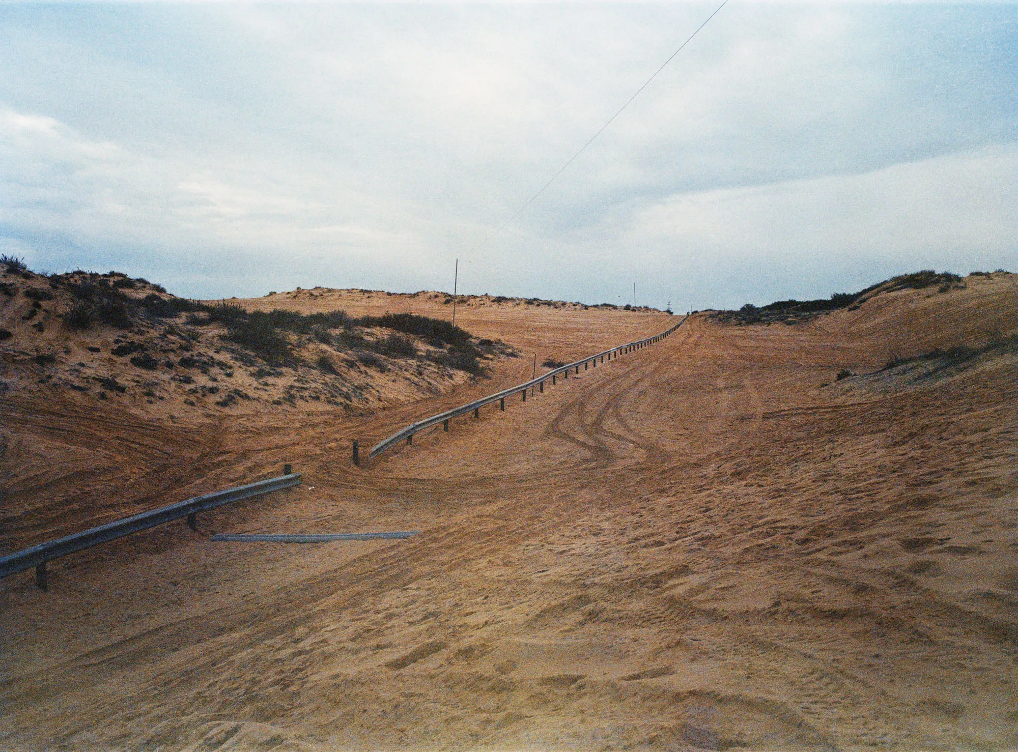
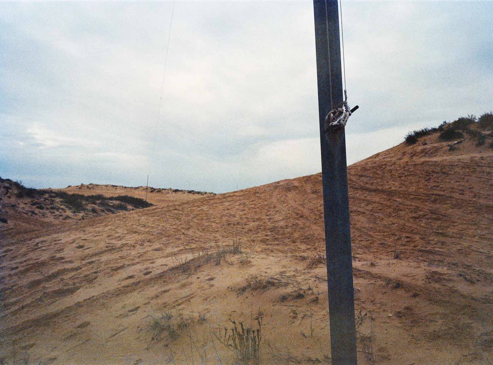
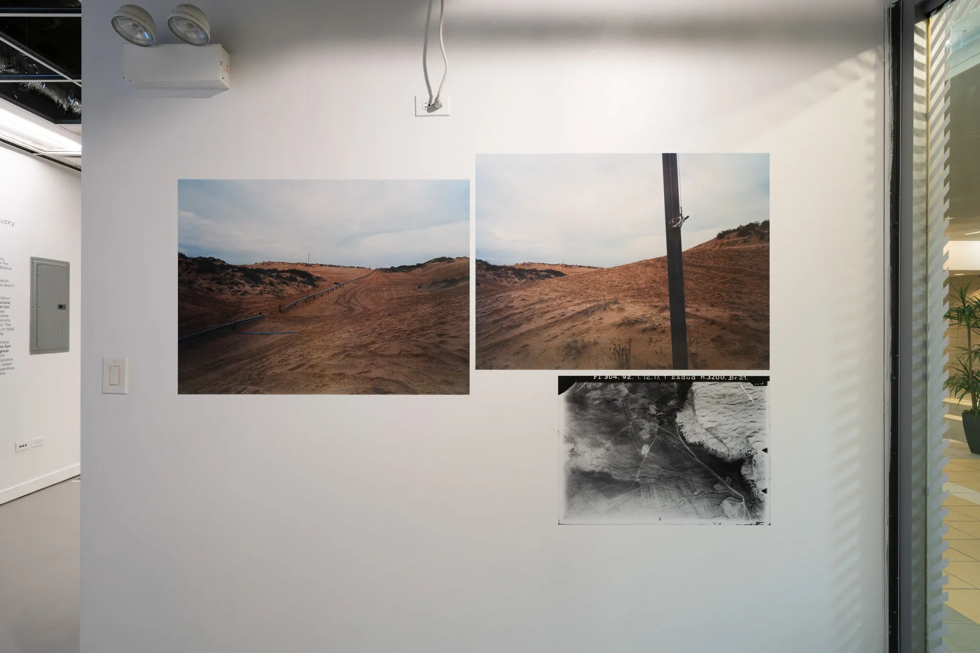
View of Esdud, Palestine, 1917. The 304th Bavarian Squadron Collection.
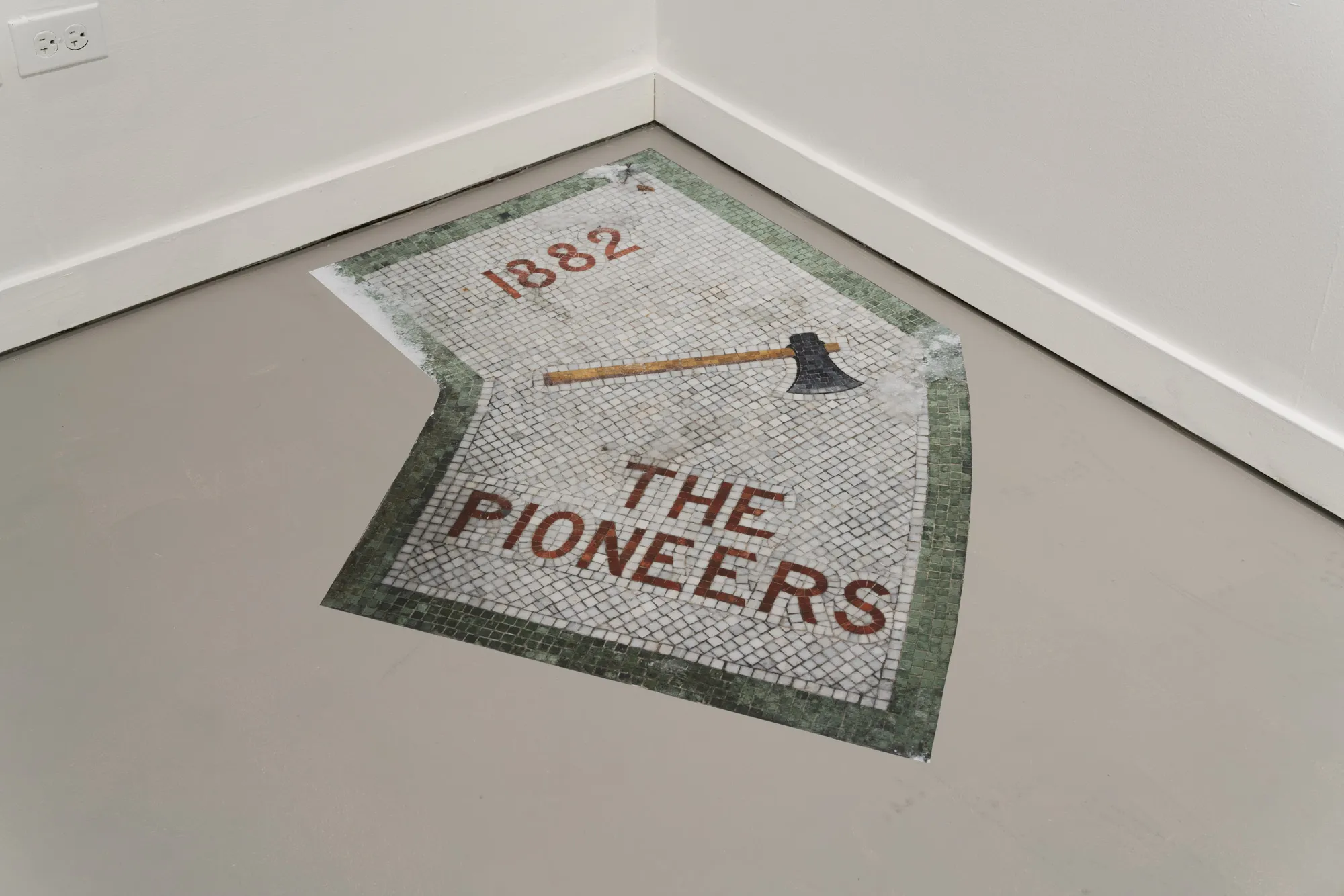
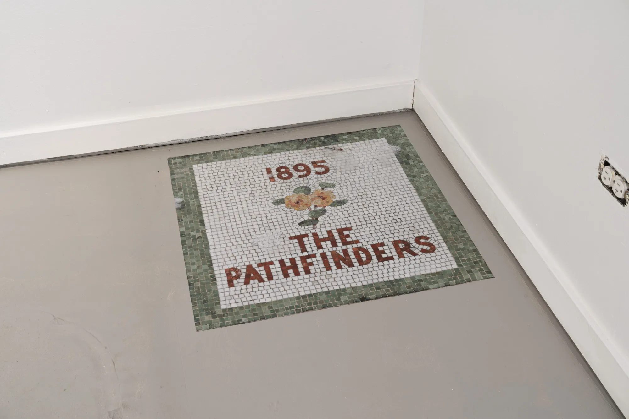
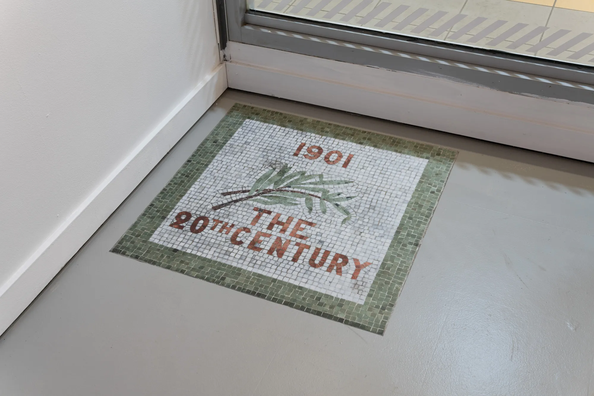
Tiles for the classes of 1882, 1895, and 1901. Hall of Philosophy, Chautauqua Institute, NY.
While I recognize the importance and impact of direct action against Israeli cultural institutions, I see my role in working to mobilize shame from within. I feel compelled to remain in conversation with that place and those who must reckon with it, even as each opportunity involves its own shame.
In this article, Noam Gal pays tribute to Allan Sekula’s essay “The Body and the Archive” (1986), analyzing the creative practice of two contemporary camera artists, Tomoko Sawada and Shabtai Pinchevsky, and the various social concerns their works evoke.
Can a Self-Driving Car Navigate an Apatheid Road will be screened at the Artport Artist Film Festival in Tel Aviv and Jerusalem.
The First Trail will be exhibited as part of Counter Landscape, curated by Karmit Galili, at Magasin III in Jaffa.